
Activity Content Sections
 GETTING READY
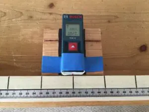
Attach the laser measuring device to a block of wood so that its rear end is flush with the edge of the block. On the rear end of the device, place a red reference line. Set the laser device so that it displays metric units.
Set up work area as in the photo.
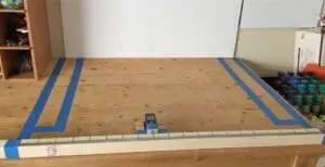 Create a back wall with foam core or use an actual wall.
Attach the reference track (2″ x 2″ x 40″ board) to the table edge closest to you. It must be parallel to the back wall.
Attach a meter stick to the reference track. Optional: Add lines every 5 cm to make measuring easier.
Use tape to mark off the work area, which will be determined by the labeling on your graph paper. (In the example here, because of the size of the graph paper, the work area extends from 10 cm to 90 cm left and right, and the back wall is about 80 cm from the reference track.)
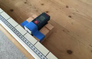 Notice that the block and laser device slide against the reference track. |
 click for full size |
Prepare graph paper by labeling it to match your work area. (In these instructions, the horizontal axis goes from 10 cm to 90 cm and the vertical goes from 20 cm to 80 cm. Each square represents 2 cm.) Print these graph sheets so that each participant gets one.
Prepare data recording sheets as shown here and print a supply. Include about 20 rows.
| Reference mark | Lidar reading (mm) | Round off to nearest cm |
| data | data | data |
| data | data | data |
Provide a supply of cardboard boxes for visitors to use to make their own landscape.
INTRODUCTION
Orient participants to this activity by explaining that once upon a time, creating a map meant sending someone to take measurements on the ground in person—a difficult, time-consuming project. Taking pictures from a plane or from space is helpful, but in many places the ground is covered by trees and it’s impossible to know what is below.
Lidar (which stands for “light detection and ranging”) is a technique used by scientists and engineers to measure distances and create maps by bouncing laser light off of surfaces. Similar to radar (which bounces radio waves) or sonar (which bounces sound waves), lidar measuring devices send out a pulse of laser light and then time how long it takes for the reflection of that light to come back to the measuring device. That information, along with knowing the speed of light, allows the device to calculate the distance to the object.
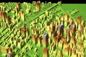
By taking lots of these distance measurements, lidar can create a map of an entire landscape. These maps can be extremely accurate and show such features as the shape of a landscape, the heights of trees, and the paths of rivers, or even give clues to buried archaeological sites or gas reserves.
Instructions
- Explain to participants that they will be bouncing laser light to map a “landscape” that they will construct.
- To demonstrate, use a rubber ball and bounce it several times on the floor. Point out how long it takes for the ball to return to your hand. Now bounce the ball off of a tabletop or bench to show that it takes less time for the ball to return to your hand, because the ball has less distance to travel.
- Explain that you could walk along bouncing a ball and sort of figure out the heights of objects that you bounce it off of by seeing how long it takes for the ball to get back to your hand.
- Demonstrate how to use the laser measuring device by pointing it at various objects and reading the distances. (It should be set to display metric units for measuring ease.)
- Remind participants never to point the laser at anybody, even though the lasers are rated eye-safe.
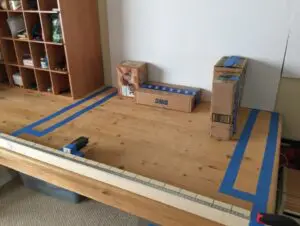
- Have the participants set up a simple landscape consisting of three or four cardboard boxes. It is best if the boxes are pushed flush with the back wall. Be sure that the boxes stay within the work zone that you have marked with tape.
- Next, show how to slide the laser device on its block along the reference track, lining up the red line on the laser device with the numbers on the meter stick. Show how to read the display on the device to see the distance from the reference track to the front of each box.
- Participants should now slide the laser device every 5 cm and then take and record their readings on their data recording sheet. In the center column, they record the readings as they are on the device display (i.e., in millimeters). In the next column, they round off to the nearest centimeter.
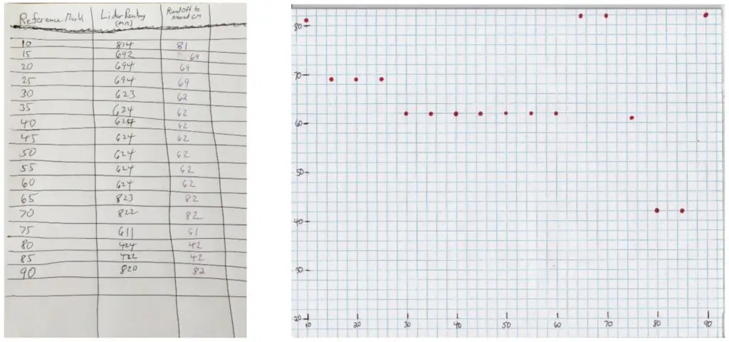
- Next, tell participants to transfer the data from their table to the graph paper. Depending on participants’ age and skill, assist with graphing as needed.
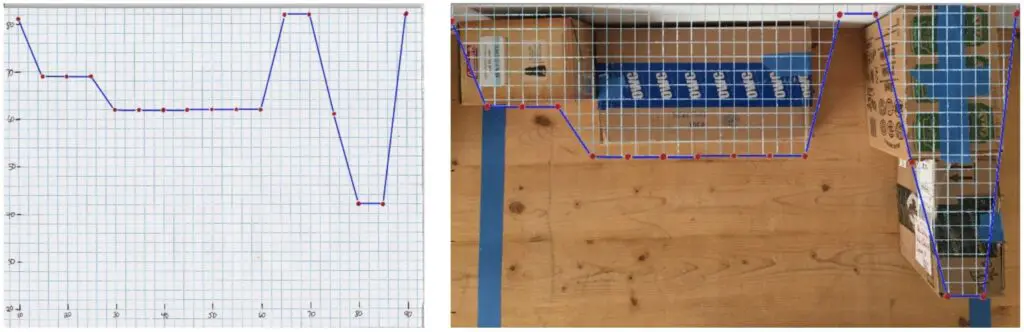
- Connect the dots. This will give a general shape for the boxes that they measured. They can see how their graph approximately represents the shape of the boxes on the table. They can even sketch the shapes of the boxes onto the graph paper to see the relationship.
As time allows, conclude the activity with this more challenging step:
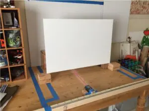 Explain that in a real-life situation, lidar data points are taken without actually seeing the objects or landscape being imaged. In fact, data collection may be completely automated, with nobody actually looking at the landscape. Invite participants to try their hand at mapping a landscape that they cannot see:
- Place a piece of foam core in front of the boxes as shown. The foam core must be mounted with a gap at the bottom so that the laser can shine underneath it to the boxes.
- Have one participant secretly set up the boxes to make a landscape, and a second participant take lidar measurements and do the graphing to try to construct an image of the landscape.
ACTIVITY VARIATIONS
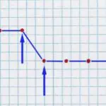
What does this graph represent?
More data points:
- One major problem arises when you measure two data points right next to each other that have different values. It is impossible to know what happened in between those two data points.
- It could mean that the boxes were pushed to the left, pushed to the right, or even have a gap in between them…maybe even something else! The truth is that it is impossible to know. To find a possible answer, engineers increase the resolution—that is, they take measurements closer together. Have participants take measurements every 1 cm in these areas.
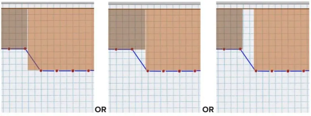
TROUBLESHOOTING
Be sure that the laser measuring device that you purchase is rated “eye- safe.” Even with that, caution participants not to look directly at the laser or point the laser at anybody else.
Relevant Terminology
Lidar: Light detection and ranging. A system that measures the time it takes for light to bounce off a remote object and return to the sensor to calculate the distance to that object.
Laser: Light that is of a pure color and whose waves are all in phase. It is a very focused type of light that is used to measure distances in lidar units.
Resolution: The number of data points that you take in a certain area. The more data points, the higher the resolution, and the more accurately your map reflects the actual object you are imaging.
Remote imaging: Any technique that creates a picture or map of an object from a distance.
GPS: Global Positioning System. A system of satellites and receiving units that accurately tells you where you are on (or above) the Earth’s surface.
Guiding Questions
STEM Connections
GUIDANCE FOR PARTICPANTS
Engineering Connections
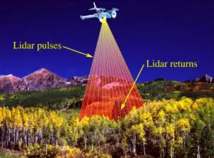
Illustration showing how the laser beam sweeps back and forth as the plane flies forward. Credit: USGS.
Lidar is very useful for capturing information about a building. The laser signals are sent out at a much higher resolution than the 5 cm used in the activity. This allows an engineer to capture an exact record of a building, either on the inside or the outside. The detail becomes a record of the current condition. This three- dimensional detail can even be printed out using a 3-D printer to provide an exact scale model of a building. On a larger scale, lidar can be used to give a digital representation of an area that includes several buildings.
Lidar is being used for some amazing things, such as mapping landscapes to make maps, checking the health of forests, determining where water might go in a flood, planning new neighborhoods, monitoring coastlines to see the effects of global climate change, searching for oil, discovering ancient Mayan cities, making virtual objects for video games, tracking the weather, checking the speed of cars, and guiding self-driving cars.
Science Connections
The main principle that lidar works on is this mathematical formula:
Distance = Rate x Time
For example, if a person is walking at a rate of 3 miles per hour and they have been walking for 4 hours, you can figure out how far they have walked. Their distance equals 3 miles per hour times 4 hours, which is 12 miles.
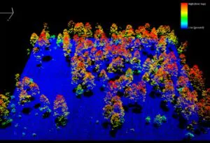
An actual lidar image of trees in a forest. Credit: Zhuoting Wu, USGS.
The same idea works with lidar, only much, much faster. The speed of light is about 300,000,000 meters per second. That is so fast that a laser pointed at the moon would reach there in less than 1.5 seconds! At that speed, light takes only a little more than 3.3 billionths of a second to travel one meter. The laser measuring device that you used in your activity is measuring the time it takes for light to go from the device to the cardboard box, then back again. So, if the device measures that the light took 3.3 billionths of a second to make the round trip to the box, it means that the round trip is 1 meter, and the distance from the device to the box is half of that, or 0.5 meters.
Lidar measurements are often made by airplanes flying over a landscape. The laser sweeps back and forth, and computers use all of the data gathered to piece together a map of the ground beneath. Trigonometry must be used to account for the fact that lidar sweeps back and forth at an angle and not always straight down.


Leave feedback form
Thank you! Your submission is processing.